Benefits Of Reality Capture And Why You Should Use It
Reality capture is a highly transformative technology that bridges the gap between the physical world and computer-based models. This rapidly evolving technology is creating a seismic shift in how different type of projects are approached, from design to execution. In this article, we delve into the benefits of reality capture and why you should use it.
At its core, the term “reality capture” refers to the process of capturing a physical asset surveyed in its current state and translating that into a digital format to create a virtual 3D representation that is often photorealistic. The process is very fast in comparison to other methods of creating virtual 3D models, saving money and time.
Using hardware such as laser scanners, drones equipped with cameras or lidar equipment, reality capture is able to collect vast amounts of data about the physical world.
This could be any asset, from a building, construction site, an infrastructure system or any other physical entity, such as a car, artifacts or construction site.
The reality capture data is then processed using software, such as our very own REBIM® tool, to accurately create 3D models, that can then be used in various applications ranging from design visualisation to asset management.

Top Benefits of Reality Capture Technology
Reality capture tools have so many capabilities and the benefits offered are so broad, they will positively impact projects, whether large or small.
Whether it’s for mapping natural landscapes, recreating historical sites or designing innovative spaces, the technology offers invaluable insights and streamlines processes.
Here are some of the most impactful benefits this technology brings to a wide range of industries:
Accurate Representation of Physical Environments
Reality capture provides a fast and efficient method to obtain a high-definition and detailed virtual representation of any physical environment.
Clarity and Precision. Through tools like 3D laser scanning, professionals can obtain high-definition digital representations. This accuracy ensures that what you see digitally is a near-perfect reflection of the actual environment conditions.
Timely Updates. Regularly utilising reality capture techniques ensures up-to-date information, helping stakeholders to make prompt and informed decisions on the progress of a project.
Streamlining Workflow and Quality Control
Implementing reality capture techniques can result in significant cost savings on single projects and enhanced efficiency.
Faster and Cheaper. Very efficient way to produce a 3D representational model in comparison to traditional CAD and BIM models.
Reduced Rework. Accuracy in capturing data minimises errors, which helps to reduces the potential for expensive corrections or reworks during a project.
Efficient Resource Allocation. Precise and up-to-date information helps in optimal resource allocation, ensuring tasks are completed efficiently.
Enhancing Collaboration
Shared and accurate data sets the stage for enhanced and greater collaboration among stakeholders.
Clearer Communication. A shared digital representation minimises misunderstandings between your project teams. All members involved, from designers to ground teams, operate with consistent and accurate data.
Informed Decision Making. The precision of reality capture data guarantees decisions made by project management are made using solid evidence and insights.
Safety Enhancements
The potential of reality capture also extends to increasing safety protocols.
Risk Assessment. Regular capture of environments allows for early identification and mitigation of potential safety hazards.
Training and Familiarisation. Before entering any environment or making site visits, individuals can acquaint themselves with it using the digital model, helping them anticipate and navigate potential challenges beforehand.

Different Reality Capture Data Capture Methods Available
Using reality capture technologies really helps revolutionise the way we document, analyse and recreate physical environments and it is easy to see why it is quickly becoming an indispensable part of project workflows.
The field of reality capture is enriched with a range of technologies that offer distinct capabilities and uses for project managers and professionals.
As these tools continue to advance, they offer even greater potential for various industries, from construction and archaeology to entertainment and virtual reality.
Let’s explore some of the specific types of reality capture solutions available and how the technology can be used.
Laser Scanning and 3D Laser Scanning
Laser scanning involves directing a laser beam at surfaces to measure distances. This data is then compiled to create detailed and highly accurate 3D models, often referred to as “point clouds”.
3D laser scans offer an even more detailed capture using precise measurements, allowing professionals to visualise intricate details, analyse accurate information and understand the nuances of a structure, site or object.
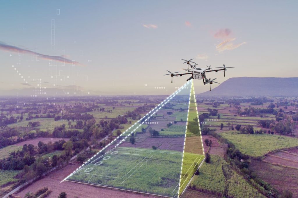
Photogrammetry and Drones
By analysing multiple images taken from different angles, photogrammetry allows teams to create accurate 3D models and maps. This method is widely used in fields such as surveying, archaeology and urban planning.
For example: Drones equipped with high-resolution cameras fly over a site, taking numerous overlapping photos.
These photos are then stitched together using software to create valuable 3D models or BIM models of the captured area, enabling a bird’s-eye view of the environment or job site and aiding in project planning.
Lidar Technology
Lidar (Light Detection and Ranging) uses light in the form of a pulsed laser to measure variable distances to the Earth.
The resulting data can then be used to make digital 3D representations of the target.
360° Reality Capture
This involves capturing the environment in a full 360-degree view using specialised cameras.
It gives stakeholders a comprehensive perspective, allowing them to virtually “walk the site” and view site conditions from every angle.

How Accurate Is Reality Capture?
The accuracy of reality capture in the construction industry and other sectors is highly reliable, subject to the quality of the software and hardware used.
This technology transforms raw data from 3D scans and mobile mapping into valuable, actionable information, accurately reflecting the as-built data and conditions of a project or site.
For example, in construction, this accuracy is vital for planning, design validation and ensuring that the built structure aligns with its design specifications.
Typically, the precision of 3D scans in reality capture can vary depending on the equipment used. High-end scanners, such as the Leica BLK range offer incredibly detailed captures, often to the millimetre.
This level of detail is crucial in the construction industry for detecting discrepancies early in the building process, thereby saving time and resources.
For example, comparing 3D scans of a building under construction with its design model can reveal structural deviations or inconsistencies that might otherwise go unnoticed until they become costly problems.
How Is Reality Capture Data Processed And Utilised?
The processing and utilisation of reality capture data, encompassing scan data, capture images and geospatial datasets, represent critical stages in transforming raw data into valuable digital assets. This process is fundamental across various fields, including architecture, engineering and urban planning.
Initially, reality capture involves collecting scan data and images using technologies such as 3D scanners, drones and photogrammetry.
This scan data typically consists of millions of data points that create detailed representations of physical spaces or structures. In construction and engineering, this accurate site data is pivotal in creating a Building Information Model (BIM) or a digital twin of a structure.
Once the scan data is collected, it undergoes processing through specialised reality capture software applications.
This software stitches the captured data together, converting vast point clouds and capture images into coherent, detailed 3D models or geospatial datasets.
These datasets are then often integrated into CAD software such as REBIM® software, enabling stakeholders to interact with and analyse the asset in a virtual environment, leading to improved efficiency and informed decision-making.

Reality Capture Use Cases
Reality capture technology is transforming numerous sectors with its advanced data capturing capabilities.
Here are some key instances where the real value of reality capture is evident:
1. Architectural Planning and Design. Architects use reality capture for accurate measurements and visualisations of buildings, facilitating more precise designs.
2. As Built 3D Models of Existing Buildings. Quickly create a 3D model of the as-constructed state of any building without requiring a CAD or BIM model.
3. Efficient method for 3D City Models. Create 3D city models for massing, urban planning, traffic planning and weather simulations.
4. Historical Site Documentation. It’s essential for creating detailed records of heritage sites for preservation and study.
5. Construction Progress Monitoring. In the construction industry, it aids in tracking project progress and verifying compliance with plans.
6. Infrastructure Inspection and Maintenance. Used for inspecting bridges, roads and railways, enabling detailed assessments without disrupting traffic.
7. Forensic Analysis and Law Enforcement. It helps in crime scene analysis, providing detailed and accurate scene reconstructions.
8. Industrial Plant Management. Reality Capture assists in monitoring plant conditions and planning maintenance activities.
9. Topographic Mapping and Surveying. For creating detailed topographic maps, especially in areas difficult to access.
10. Film and Entertainment Industry. Used for creating detailed sets and virtual environments for films and video games.
11. Environmental Studies and Conservation. Helps in tracking changes in natural environments, aiding conservation efforts.
12. Real Estate and Property Management. Facilitates virtual tours and accurate assessments of property conditions.

What Are The Challenges or Limitations of Reality Capture?
While reality capture technology serves a vital role in various sectors, from enhancing the design process in construction projects to assisting management teams in decision-making, it’s not without its challenges and limitations.
Understanding these is crucial for everyday users, companies and industries considering or operating their own reality capture programs.
The Cost of Reality Capture
One of the primary challenges of reality capture is its cost. For smaller companies especially, the initial investment in high-quality scanning equipment and software can be prohibitive.
This technology often requires significant upfront capital, making it a less viable option for businesses with limited budgets. This cost barrier can prevent smaller companies from leveraging the full benefits of reality capture in their construction projects or other applications.
However, it should be noted that in many cases it is often faster and cheaper to obtain an as-constructed 3D model of a built asset when compared to the cost and time associated with creating a CAD or BIM model of similar accuracy.
Technical Know-How
Technical complexity is another notable constraint. Operating reality capture technology such as scanning equipment or the use of drones efficiently requires a certain level of expertise. Training a management team or staff to proficiently use this technology can be time-consuming and costly.
This complexity also extends to the integration of reality capture data into existing systems and workflows, which can be a challenging process for organisations without prior experience.
Data Capture File Size
The file size of the data captured can be enormous, posing challenges in terms of data storage and management. Larger file sizes demand more robust storage solutions and can lead to increased costs and complexities in data handling.
This can be a significant issue for everyday users or smaller firms with limited IT infrastructure.
Environmental Limitations
Environmental limitations also impact reality capture’s effectiveness. Certain environments may pose challenges for accurate data collection due to poor lighting, reflective surfaces or obstacles obstructing scanner views.
These factors can compromise the accuracy of the data, which in turn affect the main purpose and effectiveness of the technology in critical processes like the design and planning stages of construction projects.
Wrapping Up The Many Benefits Of Reality Capture
As you can see, there are many benefits of using reality capture across a wide range of industries and by integrating this solution into your project workflow, you will notice a significant leap forward in efficiency, accuracy and overall project management.
The key to unlocking the full potential of this technology lies in the effective processing and management of the captured data. This is where REBIM® software emerges as an indispensable tool.
By hosting your reality capture files on REBIM®, you not only ensure seamless integration into your existing systems but also benefit from enhanced collaboration, streamlined project execution and superior data management.
Embrace the future of project management by incorporating REBIM® into your reality capture strategy and witness a transformation in the way you visualise, plan and execute your projects.